
[This is my last post about Peyto Lake, I promise.]
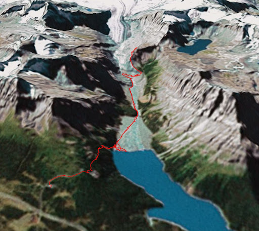
Here is a KMZ (= Google Earth) file for the trail that leads from the Peyto Lake viewing platform to Caldron Lake. It corresponds to the red line in the screenshot below. It is obvious that we never got to Caldron Lake…
You can also see some of the photos in Google Earth, if you download and open this file.
